Air Quality Community Summer 2009 Meeting
| Main ESIP page >> Main AQ WG page |
Candidate Focus Areas for ESIP AQ WG
See Re-Revised Agenda for Thursday Below
See links section below for links to USE CASE pictures, GEO TASK SHEETS.
Remote meeting info below. See below.
potential focus areas
- standard interface for surf data - what is it?
- standardization for for data prior to model ingest
- better / more standard model compare tools
- feedback to model development (and other upstreams) (ok, everywhere)
- improve transparency metadata, capturing user feedback for downstream products
- new outputs from airnow
- add'l data for easy ingest into AQ forecasting process
- 'more transparency for forecast story e.g. Fx discussion
Goals
The Air Quality data landscape is evolving: a number of efforts are underway to improve access to data, make better use of that data for decision support, and build an interoperable system-of-systems to achieve as much as we can with the data we've invested in.
At the ESIP Summer 2009 Meeting we'll convene to
- Review important developments, including
- Evolution of various systems (new tools, systems discontinued, connections formed)
- Air quality community infrastructure developed in Phase 2 of the GEO Architecture Implementation Pilot
- EPA OAQPS review of the AQ data systems they maintain and use
- Review Developing Strategies. EPA would like feedback on OAQPS's evolving Data Systems Strategy, from the larger ESIP community (not just air quality)
- Think about where to go next
- Are we making progress on the goals from the 2008 Data Summit?
- What's the next step for the GEO Architecture? Has AQ participation in the AIP been useful? What are the priorities for the next round?
- How do we build community? Feedback sought for the funding and policy crowd
- US agencies are on the hook to show AQ results from GEOSS at the November Washington DC GEO Plenary. We intend to use this as a hook to engage overseas colleagues too. Brainstorm on how to do this.
Logistical Notes and Call for Feedback
The entire meeting will be accessible remotely. We will be using GoToMeeting and a teleconference phone line.
Here are the remote access logistics. Note that the meeting codes will be different on Wednesday and Thursday.
Wednesday access:
1. Join the meeting, Wednesday, 8 July at 1:00 PM Pacific Daylight Time (20:00 UTC). Weds. GoToMeeting link
2. Join the conference call: 1-866-489-0573 passcode *2279431*
Meeting ID: 638-428-170
Thursday access:
1. Join the meeting, Thursday 9 July at 9:00 AM Pacific Daylight Time (16:00 UTC). Thurs. GoToMeeting link
2. Join the conference call: 1-866-489-0573 passcode *2279431*
Meeting ID: 978-308-570
The agenda is not fixed and your feedback is welcome. Editing the agenda table is tricky so add comments here or email them to David McCabe (McCabe dot David at epa).
Agenda: Overview
Broadly, we plan to use Wednesday to brief/update and identify important issues, then use Thursday to more systematically work through those issues to identify areas of general agreement and direction, and end with advice to ourselves (ESIP-AQ and the AQ Community of Practice), USGEO/GEO, EPA and NASA.
The agenda looks more structured than it is, and this will be a user-interest driven discussion in the spirit of ESIP!
We propose to use Block 1 to get perspectives and quick updates (where appropriate) from some of the major institutions, connected, where possible to some or all the 5 questions (below). In Block 2 we seek perspectives on these questions from a few initiatives that are directly working to connect data to users in novel ways. From this we will discuss what Common Infrastructure we need, and what we have in GEOSS and other places. We will then review and discuss work EPA's OAQPS did subsequent to the Data Summit, on its own internal infrastructure.
In Block 3 we'll invite synthesis and observations from different parts of the funding foodchain: what are funder priorities and how do they relate to issues identified on Wednesday? We'll then move into a general brainstorm session to identify and refine a working set of key issues/opportunities. In Block 4 we propose to examine 1 - 2 use cases of aspirational AQ data value chains (e.g. our preferred 4 year future, starting from status quo) at an intermediate level of detail (e.g. 6 - 10 boxes with arrows). This is an experiment to see if we can flesh out applied examples to illustrate our broad goals of "interoperability" and "collaboration". Next we take these use cases and ask, "What would need to happen at key points to obtain this future?" and, "What barriers or incentives exist to make these things happen?".
After lunch, we'll seek a summary of the key insights. Then we'll apply that discussion to develop comments for how GEO and USGEO (Block 6) and ESIP-AQ and the broader AQ Community of Practice (Block 7) could work better to move us towards that preferred future.
Questions for Wednesday Presenters
Guidelines for Presenters: First, please note that presentations are very short (15 minutes including a few minutes for clarifying questions) and we intend these sessions to be informal. We suggest you start off with whatever key updates or new you think of interest to the group, and then address 2 - 4 of the questions below, as they seem relevant and interesting...we'll be capturing key points as we go to circle back to later in the discussion.
1. What user needs are you especially focused on now?
- What use cases, or application areas, are most active for you right now and what are you learning from them?
2. What externally re-usable services you are working to offer now or plan/aspire to offer in the future?
- What non-end-user / machine-consumable services are you working on now that you think are most important or needed?
3. What service(s) do you wish were available now from others? What would you do with them?
- can you name 1 - 2 data, analytic or other services you could put to use if they were more available?
4. What common infrastructure do you think is most needed to improve flows and utilization of AQ data?
- What does common infrastructure mean to you?
5. What specific barriers to establishing this common infrastructure?
- what do you see as the most important barriers to better availability and utilization of AQ data outside your organization?
| Block | Subject | Presenter |
| Block 1 | Welcome, Objectives, Approach (.pdf) | McCabe |
| Goals & Agency Perspectives | EPA GEO perspective (.pdf) | McCabe & Keating |
| NASA/CEOS perspective (.pdf) | Hilsenrath | |
| Weds. Afternoon | GEO pespective | Friedl |
| USGEO perspective | Lindsay and Young | |
| OAQPS perspective (.pdf) | Scheffe | |
| State/Local AQM perspective (.pdf) | Dye | |
| ---------- | ------------------------ | ------------- |
| Block 2 | ESIP AQ perspective (.ppt) | Falke |
| Technical & Strategic Happenings | VIEWS and CMAS (.pdf) | Shankar or McClure |
| HTAP data connections (.pdf) | Husar | |
| Weds. Afternoon | AQ Community Infrastructure developed under GEO AIP2 (.pdf) | Robinson |
| Identify cross-cutting themes to develop Thursday | Sweeny | |
| ---------- | ------------------------ | ------------- |
| Block 3 | OAQPS Air Assessment and Strategy (.pdf) | Mintz / Scheffe / Sweeny |
| Common Themes, Needs/Opportunities | Panel discussion on Common Infrastructure - what is it? Is it what we need? (GCI and beyond) | Lieberman, Singh, Young, Falke, Lindsay |
| Thurs. Morning | ||
| ---------- | ------------------------ | ------------- |
| Block 4 | Facilitated Discussion: consider 1 or 2 use cases as thought experiments to spell out the interoperability we envision | |
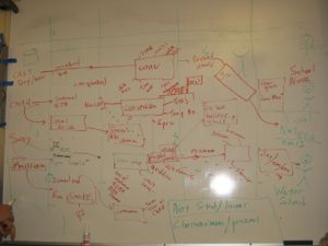
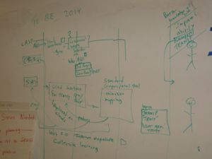
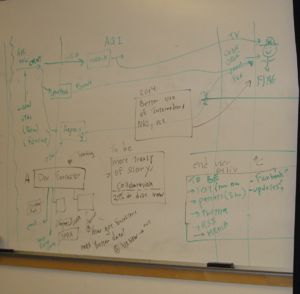
| Vision and Practical Progress | Two Use Cases worked on: Nitrogen Assessment and AQ Forecasts for School Nurses | |
| Thurs. Morning | Nitrogen Assesment: How it works now (.jpg) | |
| Nitrogen Assesment: 2014 Vision (.jpg) | ||
| AQ Forecasting now & in the future (.jpg) | ||
| ---------- | ------------------------ | ------------- |
| Block 5 | What can funding agencies do to improve data use? | Keating and Friedl |
| Document: Cyberinfrastructure for AQM (.pdf) | ||
| Thurs. Afternoon | Continuation of Use Case modeling. | |
| Identification of priority actions | ||
| ---------- | ------------------------ | ------------- |
| Block 6 | GEO/USGEO discussion | |
| Feedback for USGEO and GEO, next steps for ESIP-AQ | Where does ESIP-AQ go next, over the next 4 months / 1 year? How do we build an AQ Community of Practice and reach out, nationally and internationally, to capitilize on these opportunities? What concrete activities should the CoP take on? | |
| Thurs. Afternoon | ||
Links
- Thursday's Meeting Recorded (NOTE: 1.5Gb), streams as a wmv file.
- Picture of N Watershed 2009 Use Case
- Atmospheric Model Eval Ntwk GEO Task
- HE-09-02a Task
- HE-09-02b Task
- HE-09-02d Task
- new: webaccess to all task sheets http://www.earthobservations.org/geoss_ts.shtml
Participants
- Karl Benedict U New Mexico
- Amy Budge U New Mexico
- Tim Dye Sonoma Technology, Inc
- Stefan Falke Northrop Grumman, Washington University in St. Louis
- Kathy Fontaine NASA
- Lawrence Friedl NASA
- Ted Haberman NOAA
- Ernie Hilsenrath NASA
- Les Hook ORNL (NARSTO)
- Greg Leptoukh NASA
- Josh Lieberman OGC
- Frank Lindsay NASA
- Glynis Lough Battelle
- David McCabe USEPA
- John McHenry BAMS
- Stan Morain U New Mexico
- Erin Robinson Wash U, St Louis
- Rich Scheffe USEPA
- Uma Shankar CMAS (UNC)
- Raj Singh OGC
- Bill Sonntag USEPA
- Louis Sweeny facilitator
- John White USEPA
- Phil Yang Geo Mason U
- Steve Young USEPA
- Alexis Zubrow CMAS (UNC)
Virtual Participants
- Rudy Husar Wash U, St Louis
- Rob Koopman GEO
- Tom Moore WRAP
- Sean Raffuse Sonoma Technology, Inc
- Ed Washburn USEPA
- Mark Stoelting Bay Area AQMD
- Que He
- Bret Schictel VIEWS
- George Percivall OGC
- David Mintz USEPA
FUNding Friday: Air Twitter
Many organizations are “listening” to the social-media chatter on the web in order to better serve their users. Washington University with the AQ Workgroup, proposes to monitor user-generated web content like, Twitter, blogs, Delicious and Flickr for Air Quality phrases in order to identify air quality events as they happen and harvest user concerns and requirements for the AQ Community.
Using existing aggregation services, we will mashup the search results from the social media sites using Yahoo Pipes. This aggregate feed will be tweeted with the air quality “community hash-tag” (e.g., #airquality). The Twitter RSS feed will be fed into air quality systems, such as the ESIP Air Quality Portal and the AQ Workgroup will monitor the feed. As appropriate, AQ Workgroup members will provide responses to the AQ social media by twittering relevant links (e.g., KML data layers or Smog Blog explanations).
The Air Quality Workgroup will archive the feed in order to conduct temporal trend analysis that can be used to separate the background noise from AQ events in the social media stream. When events are identified, the location will be found by IP addresses or parsing the description associated with the content. The AQ Workgroup could then provide a link to an data console with surface, satellite and model data for the given space and time to support AQ event evaluation. This higher grade information could be distributed in near near-real-time to AIRNow and others in order to assess where air quality events may be occurring and allow the AQ community to provide appropriate response and information at the right time.
Funding: 5K
Specific activities: Supports an undergraduate/graduate student (Wash U.-St. Louis) to set up the feeds and perform initial feasibility of this arrangement. The student can begin assessment of the utility of responses and analyses.
January 2010 ESIP Meeting: Report on initial four months of data and provide outbound services.
Other / old versions of the agenda
Previously the agenda was on over here; for clarity I have moved it here. Please edit / comment here instead of on that page.


