Viewers:  | | 
|
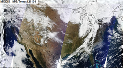
Description: MODIS Daily True Color Image Dataset Parameters: Terra, Aqua
Domain: Aerosol |
Platform: Satellite | Instrument: No Instrument |
Method: No Method |
Type: Image | Periodicity: Day"Day" is not in the list (HOUR, HALF_HOUR, SIX_HOURS, DAY, WEEK, MONTH, YEAR, FIVE_YEARS, NONE) of allowed values for the "Periodicity" property. | GeoRange: Global"Global" is not in the list (NAM, US, EUR, GLOB, SEASIA, SAM, SWASIA, AFRICA) of allowed values for the "GeoRange" property. | Time Period: 2005-2012"2005-2012" is not in the list (REALTIME, HIST, FORECAST) of allowed values for the "TimePeriod" property.
Key Use: Exceptional Event
Data Access Services: WMS | WCS
|
|
NASA EOSDIS
File:NASA EOSDISIcon.png
Provider
No Distributor
Source
Citation
Lineage
|
