ATADV
ATADV - ATADV
 |
Description: ATAD Trajectory Parameters: Trajectory |
- Browse Fields
- RDF for ATADV <- Should be a property
- What Links here on ESIP wiki
- 400px
User-Contributioned Resources. See also discussion page. Help on Edit.
Dataset Description
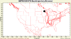
ATADV is an extensive back-trajectory database created at the Colorado Institute for Research in the Atmosphere at Colorado State University (CIRA) for each of the monitoring sites in the IMPROVE network (Interagency Monitoring of Protected Visual Environments primarily in national parks and wilderness areas) for each day between 1988 and May 2002. The ATAD dataset is used primarily in conjunction with the chemical data available from the Visibility Information Exchange Web System (VIEWS) and IMPROVE databases. ATAD is a simple single-layer back-trajectory calculator that uses the measured 3D radiosonde winds. A comparison of ATAD and HYSPLIT trajectory models is given by K. Gebhart of CIRA. http://www2.nature.nps.gov/air/studies/bravo/docs/ Gebhart_BkTrj.ppt Within FASTNET the ATAD trajectory database is used as input to the Combine Aerosol Transport Tool (CATT). ATAD data were downloaded from CIRA/VIEWS website. http:/vista.cira.colostate.edu/views.
Related Links
