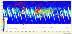
TOMS AI G
From Earth Science Information Partners (ESIP)
TOMS_AI_G - TOMS Absorbing Aerosol Index
 |
Description: TOMS_AI_G is an aerosol related dataset derived from the Total Ozone Monitoring Satellite (TOMS) Sensor. The TOMS aerosol index arises from absorbing aerosols such as dust and smoke in the upper layers of the atmosphere. Parameters: Aerosol Index |
- Browse Fields
- RDF for TOMS_AI_G <- Should be a property
- What Links here on ESIP wiki
- 400px
User-Contributioned Resources. See also discussion page. Help on Edit.
Dataset Description
Data description here
