Unused files
From Earth Science Information Partners (ESIP)
The following files exist but are not embedded in any page. Please note that other web sites may link to a file with a direct URL, and so may still be listed here despite being in active use.
Showing below up to 50 results in range #71 to #120.
View (previous 50 | next 50) (20 | 50 | 100 | 250 | 500)
 EMEPAir map.png 940 × 510; 32 KB
 EMEPPrec map.png 940 × 510; 37 KB
 EPA CAMD HOUR map.png 750 × 400; 32 KB
 EPA eGrid map.png 932 × 482; 53 KB
 FIMMA map.png 950 × 400; 38 KB
 FS FuelFire map.png 932 × 482; 252 KB
 G5FCST map.png 950 × 450; 61 KB
 GDSG FIRE map.png 932 × 482; 24 KB
 GOES IR map.png 732 × 432; 269 KB
 HMS Fire map.png 932 × 482; 35 KB
 Images map.png 732 × 382; 50 KB
 INTEX map.png 782 × 432; 235 KB
 MISRm G map.png 950 × 450; 90 KB
 MISRm L3 map.png 1,032 × 582; 125 KB
 MODIS DB AOT map.png 782 × 432; 48 KB
 MODIS Global Fire map.png 800 × 450; 324 KB
 MODISm MOD08 map.png 1,032 × 582; 96 KB
 MOPITT MO map.png 932 × 482; 73 KB
 NEXRAD RADAR map.png 800 × 450; 35 KB
 NGDC Emissions map.png 750 × 350; 26 KB
 OMId map.png 750 × 350; 237 KB
 GOMEm G map.png 950 × 450; 37 KB
 MODISd MOD08 map.png 1,032 × 582; 96 KB
 CEC Nam map.png 940 × 510; 223 KB
 SEAW Glob map.png 932 × 482; 586 KB
 THREDDS CDM 4D map.png 950 × 450; 109 KB
 THREDDS GFS map.png 950 × 450; 38 KB
 THREDDS NAM 4D map.png 950 × 450; 63 KB
 TOMS AI map.png 750 × 350; 34 KB
 WFAS map.png 732 × 382; 63 KB
 Noesis-Presentation Dec 06 Final.pdf ; 919 KB
- Esip jan07 semanticweb.pdf ; 3.93 MB
- ESIPJanetosTalk.pdf ; 23.11 MB
 SmokeDemo.ppt ; 4.5 MB
- DIAL A 2006smA.pdf ; 1.03 MB
- AERCOM2 supersites.doc ; 554 KB
- FirePixelAnalysis.ppt ; 36 KB
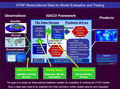 HTAP IGACO Framework.png 1,046 × 772; 426 KB
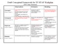 HTAP Framework Workplan.png 910 × 686; 32 KB
- Registration.04052007.pdf ; 40 KB
 CoastsOcean.Arctic.2a.png 1,536 × 960; 95 KB
- CoastsOcean.Arctic.2a.pdf ; 39 KB
- ESIP CHRONOS.pdf ; 84 KB
- ESIP ICREST.pdf ; 80 KB
- ESIP Thetus.pdf ; 69 KB


