Unused files
From Earth Science Information Partners (ESIP)
The following files exist but are not embedded in any page. Please note that other web sites may link to a file with a direct URL, and so may still be listed here despite being in active use.
Showing below up to 100 results in range #51 to #150.
View (previous 100 | next 100) (20 | 50 | 100 | 250 | 500)
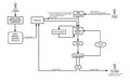
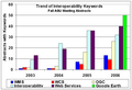 Trend WMS WCS OGC.png 737 × 501; 16 KB
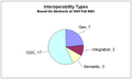 InteropAGU2006.png 742 × 444; 10 KB
 Trend WMS WCS OGC 1.png 737 × 501; 16 KB
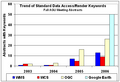 DataAccessRenderKeywords.png 590 × 402; 13 KB
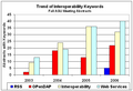 InteropKeywords.png 591 × 403; 13 KB
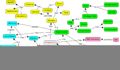
 MLs Summary.png 1,201 × 900; 14 KB
 TIWG SW 20061115.ppt ; 3.32 MB
 InteropKeywords2.png 780 × 504; 15 KB
 InteropKeywords3.png 780 × 504; 15 KB
 InteropKeywords4.png 780 × 504; 15 KB
- Eie Requirements.doc ; 38 KB
 Applications-from-the-HDF-Group.pdf ; 237 KB
- ESIP Partnership App VSTO.pdf ; 68 KB
- ESIP Partnership App-GSS.pdf ; 66 KB
 Aerosol event map.png 750 × 400; 43 KB
 CEC NAm map.png 940 × 510; 223 KB
 CIESIN map.png 932 × 482; 61 KB
 EMEPAir map.png 940 × 510; 32 KB
 EMEPPrec map.png 940 × 510; 37 KB
 EPA CAMD HOUR map.png 750 × 400; 32 KB
 EPA eGrid map.png 932 × 482; 53 KB
 FIMMA map.png 950 × 400; 38 KB
 FS FuelFire map.png 932 × 482; 252 KB
 G5FCST map.png 950 × 450; 61 KB
 GDSG FIRE map.png 932 × 482; 24 KB
 GOES IR map.png 732 × 432; 269 KB
 HMS Fire map.png 932 × 482; 35 KB
 Images map.png 732 × 382; 50 KB
 INTEX map.png 782 × 432; 235 KB
 MISRm G map.png 950 × 450; 90 KB
 MISRm L3 map.png 1,032 × 582; 125 KB
 MODIS DB AOT map.png 782 × 432; 48 KB
 MODIS Global Fire map.png 800 × 450; 324 KB
 MODISm MOD08 map.png 1,032 × 582; 96 KB
 MOPITT MO map.png 932 × 482; 73 KB
 NEXRAD RADAR map.png 800 × 450; 35 KB
 NGDC Emissions map.png 750 × 350; 26 KB
 OMId map.png 750 × 350; 237 KB
 GOMEm G map.png 950 × 450; 37 KB
 MODISd MOD08 map.png 1,032 × 582; 96 KB
 CEC Nam map.png 940 × 510; 223 KB
 SEAW Glob map.png 932 × 482; 586 KB
 THREDDS CDM 4D map.png 950 × 450; 109 KB
 THREDDS GFS map.png 950 × 450; 38 KB
 THREDDS NAM 4D map.png 950 × 450; 63 KB
 TOMS AI map.png 750 × 350; 34 KB
 WFAS map.png 732 × 382; 63 KB
- Noesis-Presentation Dec 06 Final.pdf ; 919 KB
- Esip jan07 semanticweb.pdf ; 3.93 MB
- ESIPJanetosTalk.pdf ; 23.11 MB
- SmokeDemo.ppt ; 4.5 MB
- DIAL A 2006smA.pdf ; 1.03 MB
- AERCOM2 supersites.doc ; 554 KB
- FirePixelAnalysis.ppt ; 36 KB
 HTAP IGACO Framework.png 1,046 × 772; 426 KB
 HTAP Framework Workplan.png 910 × 686; 32 KB
- Registration.04052007.pdf ; 40 KB
 CoastsOcean.Arctic.2a.png 1,536 × 960; 95 KB
- CoastsOcean.Arctic.2a.pdf ; 39 KB
- ESIP CHRONOS.pdf ; 84 KB
- ESIP ICREST.pdf ; 80 KB
- ESIP Thetus.pdf ; 69 KB
- EPA OAR - ESIP 2007.doc ; 30 KB
- July19PreliminaryAgenda.pdf ; 27 KB
- July19 Agenda.pdf ; 30 KB
 Federation.jpg 2,341 × 1,360; 270 KB
- Esip jul07 semanticweb.ppt ; 3.75 MB
- Benedict summer2007 democode.zip ; 39 KB
- SV.Symposium.10.15-16.07.5.doc ; 37 KB
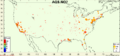 AQS map.png 448 × 208; 25 KB
- NO2Comp Flow.ppt ; 28 KB
- Bylaws 11 30 06.pdf ; 77 KB
 July4th 04.png 500 × 300; 309 KB
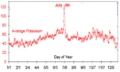 July4th 04 Airnow.png 500 × 300; 38 KB
 EEINetL.png 500 × 300; 78 KB
 EEINet.png 916 × 376; 46 KB
- ESIP NO2.pdf ; 743 KB
 UrbanEvent.png 500 × 300; 178 KB
- Aura2007.pdf ; 2.62 MB
- 071025 Scheffe AQMeasurements.pdf ; 6.69 MB
- Witch Fire.pdf ; 991 KB
- CENRdraftversion1Measurementsall.pdf ; 6.69 MB
- ESIP-AQ NO2 Conference 3DAQS.ppt ; 631 KB
- Celarier ESIPFed talk on NO2.pdf ; 1.72 MB
- 071030 NO2 Workshop.pdf ; 2.4 MB
- NO2 Mashups.pdf ; 523 KB
- ESIP Hilsenrath.pdf ; 2.07 MB
- NO2 EPA Giovanni.pdf ; 1.3 MB


