Unused files
From Earth Science Information Partners (ESIP)
The following files exist but are not embedded in any page. Please note that other web sites may link to a file with a direct URL, and so may still be listed here despite being in active use.
Showing below up to 100 results in range #1 to #100.
View (previous 100 | next 100) (20 | 50 | 100 | 250 | 500)
 Eunight1280x1024.jpg 1,280 × 1,024; 280 KB
 Internallink.png 23 × 22; 434 bytes
 AQ InfoSystemG.gif 1,600 × 1,200; 74 KB
 A-1-fea-chart.gif 370 × 117; 10 KB
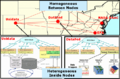
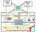
 AQO Network.gif 744 × 487; 114 KB
 AQO Network.png 744 × 487; 87 KB
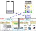 Unidata DataFedXLink.png 744 × 643; 336 KB
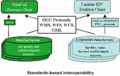 OGCProtocols.gif 877 × 559; 18 KB
 Unidata DataFedXLink.gif 1,076 × 954; 306 KB
 Unidata DataFedXLinkHalf.gif 538 × 477; 88 KB
 CATTTrajTool.gif 894 × 372; 135 KB
 US IEOS RegForm2.pdf ; 117 KB
 Bylaws 01 15 03.doc ; 89 KB
 SmokeEmissionFramework.gif 636 × 576; 39 KB
 Nodes.gif 760 × 463; 14 KB
 UnidataIDDLDM.gif 941 × 560; 23 KB
 UnidataIDDLDMS.gif 659 × 392; 47 KB
 NodesS.gif 532 × 324; 26 KB
 OGCProtocolsS.gif 614 × 391; 41 KB
 SmokeEmissionFrameworkS.gif 509 × 461; 28 KB
 CommonDataModel.gif 463 × 442; 16 KB
 Unidata DataFedXLink IDDnodeS.gif 614 × 926; 186 KB
- UseCase 08 manageGroups.doc ; 34 KB
- ESIP Partnership Application IAI.doc ; 112 KB
- Test.xls ; 21 KB
 Wickie-gr.gif 67 × 114; 9 KB
 Wickie.png 67 × 114; 9 KB
 CF forcing.jpg 595 × 842; 181 KB
- GSN Telecon 9 June 2006.ppt ; 838 KB
- Agenda Arch Workshop- NA r6.doc ; 47 KB
 UserandGEOSS Architecture.png 1,053 × 795; 134 KB
- GetStartedWithMapServer.pdf ; 660 KB
 Slide3.PNG 720 × 540; 4 KB
- ESIP WaterNet poster AGU2006 DRB.jpgESIP WaterNet poster AGU2006 DRB.jpg File missing
- AQ Framework Paper - Lindsay.doc ; 3.84 MB
- Semanticwebinfusionroadmap.ppt ; 3.47 MB
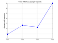
 Trend Atmospheric Oceanic.png 590 × 402; 12 KB
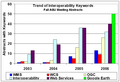 Trend WMS WCS OGC.png 737 × 501; 16 KB
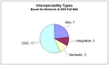 InteropAGU2006.png 742 × 444; 10 KB
 Trend WMS WCS OGC 1.png 737 × 501; 16 KB
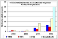 DataAccessRenderKeywords.png 590 × 402; 13 KB
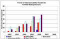
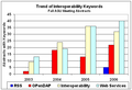 InteropKeywords.png 591 × 403; 13 KB
 MLs Summary.png 1,201 × 900; 14 KB
- TIWG SW 20061115.ppt ; 3.32 MB
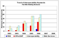 InteropKeywords2.png 780 × 504; 15 KB
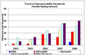 InteropKeywords3.png 780 × 504; 15 KB
 InteropKeywords4.png 780 × 504; 15 KB
- Eie Requirements.doc ; 38 KB
- Applications-from-the-HDF-Group.pdf ; 237 KB
- ESIP Partnership App VSTO.pdf ; 68 KB
- ESIP Partnership App-GSS.pdf ; 66 KB
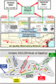
 Aerosol event map.png 750 × 400; 43 KB
 CEC NAm map.png 940 × 510; 223 KB
 CIESIN map.png 932 × 482; 61 KB
 EMEPAir map.png 940 × 510; 32 KB
 EMEPPrec map.png 940 × 510; 37 KB
 EPA CAMD HOUR map.png 750 × 400; 32 KB
 EPA eGrid map.png 932 × 482; 53 KB
 FIMMA map.png 950 × 400; 38 KB
 FS FuelFire map.png 932 × 482; 252 KB
 G5FCST map.png 950 × 450; 61 KB
 GDSG FIRE map.png 932 × 482; 24 KB
 GOES IR map.png 732 × 432; 269 KB
 HMS Fire map.png 932 × 482; 35 KB
 Images map.png 732 × 382; 50 KB
 INTEX map.png 782 × 432; 235 KB
 MISRm G map.png 950 × 450; 90 KB
 MISRm L3 map.png 1,032 × 582; 125 KB
 MODIS DB AOT map.png 782 × 432; 48 KB
 MODIS Global Fire map.png 800 × 450; 324 KB
 MODISm MOD08 map.png 1,032 × 582; 96 KB
 MOPITT MO map.png 932 × 482; 73 KB
 NEXRAD RADAR map.png 800 × 450; 35 KB
 NGDC Emissions map.png 750 × 350; 26 KB
 OMId map.png 750 × 350; 237 KB
 GOMEm G map.png 950 × 450; 37 KB
 MODISd MOD08 map.png 1,032 × 582; 96 KB
 CEC Nam map.png 940 × 510; 223 KB
 SEAW Glob map.png 932 × 482; 586 KB
 THREDDS CDM 4D map.png 950 × 450; 109 KB
 THREDDS GFS map.png 950 × 450; 38 KB
 THREDDS NAM 4D map.png 950 × 450; 63 KB
 TOMS AI map.png 750 × 350; 34 KB
 WFAS map.png 732 × 382; 63 KB


