Most linked-to files
From Earth Science Information Partners (ESIP)
Showing below up to 204 results in range #51 to #254.
View (previous 250 | next 250) (20 | 50 | 100 | 250 | 500)

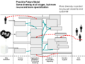
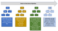 2020-03-20.Concept map icons for the data-to-decisions demo path wiki page v1.1.png Used on 3 pages
955 × 519; 43 KB


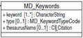


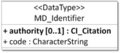
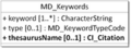
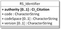
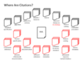
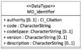
- 180px-WhereAreCI Citations.MD Identification.png


- EDGARIcon.png


- ESIP Geospatial Cluster Deploying Federal Geospatial Services in the Cloud 6.18.2012.pptx Used on 2 pages
; 1.77 MB
- ESIP Geospatial Cluster ncISO Metadata Discovery and GIS in Disaster Response 5.12.2012.pdf Used on 2 pages
; 1.78 MB


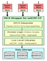
- GFED WCSIcon.png
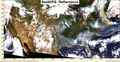
- GOES map.png


- NASA EOSDISIcon.png


 Value of Poultry and Eggs Sold as Percent of Total Market Value of Agricultural Products Sold in 2017.png Used on 2 pages
662 × 497; 38 KB


