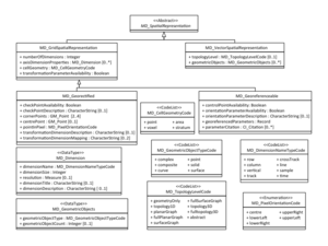
MD VectorSpatialRepresentation
From Earth Science Information Partners (ESIP)
The printable version is no longer supported and may have rendering errors. Please update your browser bookmarks and please use the default browser print function instead.
msr:MD_VectorSpatialRepresentation
| Elements | Domain | Definition and Recommended Practice | Examples | ||
|---|---|---|---|---|---|
| 1 | msr:scope | 0..1 | mcc:MD_Scope | Level and extent of the spatial representation | |
| 2 | msr:topologyLevel | 0..1 | msr:MD_TopologyLevelCode | Code which identifies the degree of complexity of the spatial relationships | |
| 3 | msr:geometricObjects | 0..* | msr:MD_GeometricObjects | Information about the geometric objects used in the resource | |


