File:Esip-dqms-fig5.png
From Earth Science Information Partners (ESIP)
No higher resolution available.
Esip-dqms-fig5.png (555 × 378 pixels, file size: 70 KB, MIME type: image/png)
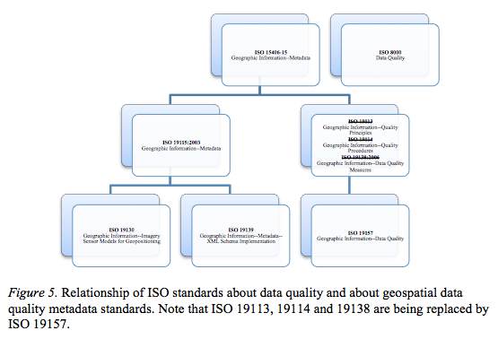
Graphic of relationship of geospatial ISO DQ standards for Figure 5 for Data Quality Metadata Standards page by Jennifer Davis
File history
Click on a date/time to view the file as it appeared at that time.
| Date/Time | Thumbnail | Dimensions | User | Comment | |
|---|---|---|---|---|---|
| current | 11:19, January 6, 2013 | | 555 × 378 (70 KB) | Jldavis (talk | contribs) | Graphic of relationship of geospatial ISO DQ standards for Figure 5 for Data Quality Metadata Standards page by Jennifer Davis |
You cannot overwrite this file.
File usage
The following page uses this file: