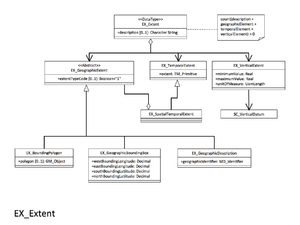
EX VerticalExtent
From Earth Science Information Partners (ESIP)
The printable version is no longer supported and may have rendering errors. Please update your browser bookmarks and please use the default browser print function instead.
gex:EX_VerticalExtent
Minimum and maximum vertical extent of the resource. Recommended if your resource has vertical coverage.
| Elements | Domain | Definition and Recommended Practice | Examples | ||
|---|---|---|---|---|---|
| 1 | gex:minimumValue | 1 | gco:Real | Lowest vertical extent contained in the dataset. | minimumValue: 3600 |
| 2 | gex:maximumValue | 1 | gco:Real | Highest vertical extent contained in the dataset. | maximumValue: 3100 |
| 3 | gex:verticalCRSId | 0..1 | mrs:MD_ReferenceSystem | Mandatory if gex:verticalCRS is not present | |
| 4 | gex:verticalCRS | 0..1 | CRS (need more info) | Mandatory if gex:verticalCRSId is not present Vertical coordinate reference system. Recommend referencing EPSG codes with an XLink instead of populating this section. |
verticalCRS:
|


