EX VerticalExtent
From Earth Science Information Partners (ESIP)
Revision as of 10:31, October 25, 2016 by Ted.Habermann (talk | contribs) (1 revision: Importing the ISO Explorer Category from GEO-IDE Wiki (Ted Habermann))
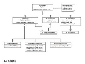
Minimum and maximum vertical extent of the resource. Recommended if your resource has vertical coverage.
| Elements | Definition and Recommended Practice | Examples |
||
|---|---|---|---|---|
| 1 | minimumValue | 1 | Lowest vertical extent contained in the dataset. | 3600 |
| 2 | maximumValue | 1 | Highest vertical extent contained in the dataset. | 3100 |
| 3 | verticalCRS | 1 | Vertical coordinate reference system. Recommend referencing EPSG codes with an XLink instead of populating this section. |
<gmd:verticalCRS xlink:href="http://www.epsg-registry.org/export.htm?gml=urn:ogc:def:crs:EPSG::5715" xlink:title="msl depth in meters" xlink:actuate="onRequest"/> |


