Difference between revisions of "Air Quality Data Network"
From Earth Science Information Partners (ESIP)
| Line 14: | Line 14: | ||
|- valign="top" | |- valign="top" | ||
|bgcolor="#CCCCCC" style="border: 1px solid gray;padding-left:0.5em;padding-right:0.5em;" width="100%"| | |bgcolor="#CCCCCC" style="border: 1px solid gray;padding-left:0.5em;padding-right:0.5em;" width="100%"| | ||
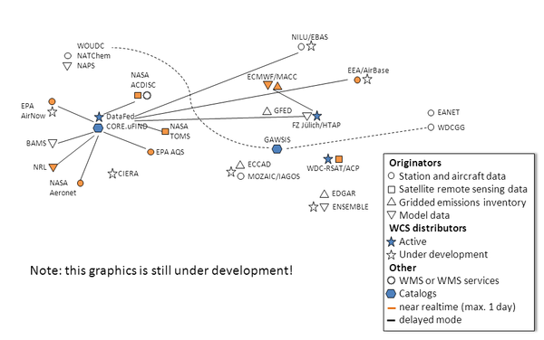
| − | <center><b><big><big>'''Network Status'''</big></big></b></center> | + | <center><b><big><big>'''Network Status (WCS enabled data flow only)'''</big></big></b></center> |
|} | |} | ||
{|Align="center" width="30%" cellpadding="0" cellspacing="0" style="zborder-top:1px solid #aaaaaa; border-collapse: collapse;" | {|Align="center" width="30%" cellpadding="0" cellspacing="0" style="zborder-top:1px solid #aaaaaa; border-collapse: collapse;" | ||
Revision as of 11:27, October 3, 2011
< Back to ![]() | Workshops | Air Quality Data Network
| Workshops | Air Quality Data Network
About | Interoperability | Standards | Servers | Catalogs | Clients | Network |Participants
Goal:
A Data Network to Find, Access, understand and merge air quality observations, emissions and models
How:
By enabling existing Data Portals, Decision and Science projects to create and use the Network
|
|
|
|
|
|
|
|