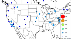
AERONETd
From Earth Science Information Partners (ESIP)
The printable version is no longer supported and may have rendering errors. Please update your browser bookmarks and please use the default browser print function instead.
AERONETd - Global Ground-Based Sun Photometer Network
 |
Description: A globally distributed network of spectral aerosol optical depth (AOD), inversion products, and precipitable water in diverse aerosol regimes, continuously, over long term. Parameters: AOT, Water |
- Browse Fields
- RDF for AERONETd <- Should be a property
- What Links here on ESIP wiki
- 400px
User-Contributioned Resources. See also discussion page. Help on Edit.
Related Links
