Difference between revisions of "0908SoCalFire"
m (Replacing feed tags with rss) |
|||
| (105 intermediate revisions by 7 users not shown) | |||
| Line 1: | Line 1: | ||
| − | + | [[Twitter FUNding Friday Project|<< Back to Twitter FUNding Friday Project]]<br> | |
| − | | | + | |
| − | | | + | <big><center>'''Interested in the August 2009 Southern Fire California Smoke Event? Please join us in harvesting web resources! To edit create an account in the upper right corner and then click the edit tab and add link.'''</center></big> |
| − | - | + | |
| − | - | + | <center>[[Image:634303457 mg 9363.jpg|300px]]</center> |
| − | - | + | <center>Ideas, comments, questions? Contact [[user:erinmr|Erinmr]]</center> |
| − | + | ||
| − | + | Smog Blog Follow-up: | |
| − | + | * [http://alg.umbc.edu/usaq/archives/003490.html Sept. 10: SMOKE IS STILL LOCATED OVER THE GREAT LAKES; GOOD AIR QUALITY CONDITIONS ACROSS U.S.] | |
| − | + | * [http://alg.umbc.edu/usaq/archives/003489.html Sept. 9: SMOKE OVER GREAT LAKES AND AIR QUALITY IMPROVING IN CALIFORNIA] | |
| − | + | * [http://alg.umbc.edu/usaq/archives/003488.html Sept. 8: MODERATE AIR QUALITY CONTINUES IN MIDWEST; MOSTLY GOOD CONDITIONS ELSEWHERE] | |
| − | + | ||
| − | + | Recent Air Quality Data | |
| − | + | * [MODIS Aqua and Terra Satellites give a true color image 2x a day [http://capita.wustl.edu/capita/kmz/MODIS_Terra_AQUA_250m%202009-08-26T060000%20-%202009-09-02T060000.kmz See KML] | |
| − | + | <html> <object width="560" height="340"><param name="movie" value="http://www.youtube.com/v/PTbYkWewA8E&hl=en&fs=1&"></param><param name="allowFullScreen" value="true"></param><param name="allowscriptaccess" value="always"></param><embed src="http://www.youtube.com/v/PTbYkWewA8E&hl=en&fs=1&" type="application/x-shockwave-flash" allowscriptaccess="always" allowfullscreen="true" width="560" height="340"></embed></object></html> | |
| + | * Fire pixels from Hazard Mapping Service identify the location as seen from satellites of the fires - [http://capita.wustl.edu/capita/kmz/HMS_FireLocs_MODIS_Aqua_090826_090902.kmz See KML] | ||
| + | <html><object width="560" height="340"><param name="movie" value="http://www.youtube.com/v/V5yL1ShbHmI&hl=en&fs=1"></param><param name="allowFullScreen" value="true"></param><param name="allowscriptaccess" value="always"></param><embed src="http://www.youtube.com/v/V5yL1ShbHmI&hl=en&fs=1" type="application/x-shockwave-flash" allowscriptaccess="always" allowfullscreen="true" width="560" height="340"></embed></object></html> | ||
| + | * Airnow - Surface monitors indicate the level of PM2.5 on the surface [http://capita.wustl.edu/capita/kmz/AIRNOW.pmfine_2008-05-18T07_00_00_-_2009-08-26T06_00_00-20090901.kmz See KML] | ||
| + | <html><object width="560" height="340"><param name="movie" value="http://www.youtube.com/v/ijs4_ewsGb0&hl=en&fs=1&"></param><param name="allowFullScreen" value="true"></param><param name="allowscriptaccess" value="always"></param><embed src="http://www.youtube.com/v/ijs4_ewsGb0&hl=en&fs=1&" type="application/x-shockwave-flash" allowscriptaccess="always" allowfullscreen="true" width="560" height="340"></embed></object></html> | ||
| + | |||
| + | * NRL NAAPS Smoke Model [http://capita.wustl.edu/capita/kmz/NAAPS_NoAm.SMOK%202009-08-26T060000%20-%202009-09-02T060000.kmz See KML] | ||
| + | <html><object width="560" height="340"><param name="movie" value="http://www.youtube.com/v/taf-UvFttoM&hl=en&fs=1&"></param><param name="allowFullScreen" value="true"></param><param name="allowscriptaccess" value="always"></param><embed src="http://www.youtube.com/v/taf-UvFttoM&hl=en&fs=1&" type="application/x-shockwave-flash" allowscriptaccess="always" allowfullscreen="true" width="560" height="340"></embed></object></html> | ||
| + | |||
| + | |||
| + | |||
| + | All of this data can also be viewed in [http://capita.wustl.edu/capita/kmz/0908SoCalFire.kmz Google Earth] | ||
| + | |||
| + | |||
| + | |||
| + | |||
| + | |||
| + | __TOC__ | ||
| + | |||
| + | === [http://news.google.com/news?um=1&ned=us&hl=en&q=so+cal+fires&as_qdr=d&as_drrb=q&output=rss So Cal Fire News] === | ||
| + | <rss max="5">http://news.google.com/news?um=1&ned=us&hl=en&q=so+cal+fires&as_qdr=d&as_drrb=q&output=rss</rss> | ||
| + | |||
| + | === [http://twitter.com/#search?q=SoCal%20Fire Twitter feed for SoCal Fire] === | ||
| + | |||
| + | |||
| + | === Videos === | ||
| + | |||
| + | ==== YouTube==== | ||
| + | To add to this list bookmark On delicious with tags (#MorrisFire and video) - All recent videos from | ||
| + | * [http://www.youtube.com/results?uploaded=w&search_query=Morris+Fire&search_type=videos&uni=1 Morris Fire search seem relevant] | ||
| + | * [http://www.youtube.com/results?uploaded=w&search_query=Angeles+Fire&search_type=videos&uni=1 Angeles Fire Search] | ||
| + | * [http://www.youtube.com/results?uploaded=w&search_query=Station+Fire&search_type=videos&uni=1 Station Fire] | ||
| + | |||
| + | <html><object width="560" height="340"><param name="movie" value="http://www.youtube.com/v/oUzQ32ngw8E&hl=en&fs=1&"></param><param name="allowFullScreen" value="true"></param><param name="allowscriptaccess" value="always"></param><embed src="http://www.youtube.com/v/oUzQ32ngw8E&hl=en&fs=1&" type="application/x-shockwave-flash" allowscriptaccess="always" allowfullscreen="true" width="560" height="340"></embed></object></html> | ||
| + | |||
| + | <html><object width="425" height="344"><param name="movie" value="http://www.youtube.com/v/GGIzATousFQ&hl=en&fs=1&"></param><param name="allowFullScreen" value="true"></param><param name="allowscriptaccess" value="always"></param><embed src="http://www.youtube.com/v/GGIzATousFQ&hl=en&fs=1&" type="application/x-shockwave-flash" allowscriptaccess="always" allowfullscreen="true" width="425" height="344"></embed></object></html> | ||
| + | |||
| + | <html><object width="425" height="344"><param name="movie" value="http://www.youtube.com/v/yVhCoRhCDLg&hl=en&fs=1&"></param><param name="allowFullScreen" value="true"></param><param name="allowscriptaccess" value="always"></param><embed src="http://www.youtube.com/v/yVhCoRhCDLg&hl=en&fs=1&" type="application/x-shockwave-flash" allowscriptaccess="always" allowfullscreen="true" width="425" height="344"></embed></object></html> | ||
| + | <html><object width="425" height="344"><param name="movie" value="http://www.youtube.com/v/S1BYjSnIcCQ&hl=en&fs=1&"></param><param name="allowFullScreen" value="true"></param><param name="allowscriptaccess" value="always"></param><embed src="http://www.youtube.com/v/S1BYjSnIcCQ&hl=en&fs=1&" type="application/x-shockwave-flash" allowscriptaccess="always" allowfullscreen="true" width="425" height="344"></embed></object></html> | ||
| − | -- | + | <html><object width="560" height="340"><param name="movie" value="http://www.youtube.com/v/uCyVCS9NNYo&hl=en&fs=1&"></param><param name="allowFullScreen" value="true"></param><param name="allowscriptaccess" value="always"></param><embed src="http://www.youtube.com/v/uCyVCS9NNYo&hl=en&fs=1&" type="application/x-shockwave-flash" allowscriptaccess="always" allowfullscreen="true" width="560" height="340"></embed></object></html> |
| − | |||
| − | |||
| − | |||
| − | == | + | ==== Vimeo ==== |
| + | <html><object width="400" height="225"><param name="allowfullscreen" value="true" /><param name="allowscriptaccess" value="always" /><param name="movie" value="http://vimeo.com/moogaloop.swf?clip_id=6333793&server=vimeo.com&show_title=1&show_byline=1&show_portrait=0&color=&fullscreen=1" /><embed src="http://vimeo.com/moogaloop.swf?clip_id=6333793&server=vimeo.com&show_title=1&show_byline=1&show_portrait=0&color=&fullscreen=1" type="application/x-shockwave-flash" allowfullscreen="true" allowscriptaccess="always" width="400" height="225"></embed></object><p><a href="http://vimeo.com/6333793">Station Fire, La Canada, CA. August 28, 2009</a> from <a href="http://vimeo.com/user1285639">Keith Skelton</a> on <a href="http://vimeo.com">Vimeo</a>.</p></html> | ||
| + | === Photos === | ||
| + | UCLA TowerCam photos - 2009-09-01 back to 2009-08-26 | ||
| − | === | + | <center><html><object width="400" height="300"> <param name="flashvars" value="offsite=true&lang=en-us&page_show_url=%2Fphotos%2F23102661%40N00%2Fsets%2F72157622208922320%2Fshow%2F&page_show_back_url=%2Fphotos%2F23102661%40N00%2Fsets%2F72157622208922320%2F&set_id=72157622208922320&jump_to="></param> <param name="movie" value="http://www.flickr.com/apps/slideshow/show.swf?v=71649"></param> <param name="allowFullScreen" value="true"></param><embed type="application/x-shockwave-flash" src="http://www.flickr.com/apps/slideshow/show.swf?v=71649" allowFullScreen="true" flashvars="offsite=true&lang=en-us&page_show_url=%2Fphotos%2F23102661%40N00%2Fsets%2F72157622208922320%2Fshow%2F&page_show_back_url=%2Fphotos%2F23102661%40N00%2Fsets%2F72157622208922320%2F&set_id=72157622208922320&jump_to=" width="400" height="300"></embed></object></html></center> |
| − | |||
| − | |||
| − | |||
| − | |||
| − | |||
| − | |||
| − | |||
| − | |||
| + | ====[http://www.astro.ucla.edu/~obs/images/towercam.jpg UCLA Astronomy Webcam:] ==== | ||
| + | According to the latest blog entry from Dr. McAlister, the Mount Wilson webserver went down. The blog, originally hosted on the Mt.Wilson webserver, is now available here: | ||
| + | http://joy.chara.gsu.edu/CHARA/fire.php. | ||
| − | + | http://media.skyandtelescope.com/images/towercam+341.gif | |
| − | |||
| − | |||
| − | + | * Twilight pics: 2009-08-26 (8-8:30pm PST) | |
| − | + | [[Image:Towercam_0908261957.jpg|300px]]| [[Image:Towercam 0908262015.jpg|300px]] | [[Image:Towercam 0908262017.jpg|300px]] | |
| − | + | * Early morning pics: 2009-08-27 (4:30, 6:30 am PST) | |
| − | + | [[Image:Towercam 0908270435.jpg|300px]]| [[Image:Towercam 0908270645.jpg|300px]] | [[Image:Towercam 0908270707.jpg|300px]] | |
| + | * Twilight 2009-08-27 - 7pm, 7:30 | ||
| + | [[Image:Towercam_0908270707.jpg|300px]] [[Image:Towercam_0908270734.jpg|300px]] | ||
| + | * Twilight 2009-08-28 (6:30, 6:50, 6:55, 7:19pm) | ||
| + | [[Image:Towercam_0908281830.jpg|300px]] [[Image:Towercam_0908281850.jpg|300px]] [[Image:Towercam_0908281855.jpg|300px]] [[Image:Towercam_0908281919.jpg|300px]] | ||
| + | * Twilight 2009-08-29 (7:19, 8:04pm) | ||
| + | [[Image:Towercam_0908292004.jpg|300px]] | ||
| + | * Twilight 2008-08-30 (7pm, 7:30pm) | ||
| + | [[Image:Towercam_0908301904.jpg|300px]] [[Image:Towercam_0908301933.jpg|300px]] [[Image:Towercam_0908301946.jpg|300px]] [[Image:Towercam_0908302033.jpg|300px]] | ||
| + | * [http://www.astro.ucla.edu/~obs/images/towercam.jpg Current Webcam Image:] | ||
| − | === | + | ====Flickr Photos - [http://www.flickr.com/search/?q=Southern+California+Fire&s=rec Southern California Fire (recent)]==== |
| − | + | * [http://www.flickr.com/groups/socalwildfires/pool/map?&fLat=34.0952&fLon=-118.2951&zl=10&order_by=recent Map showing location of some of recent pics] | |
| − | + | <html><object width="400" height="300"> <param name="flashvars" value="offsite=true&lang=en-us&page_show_url=%2Fsearch%2Fshow%2F%3Fq%3DSouthern%2BCalifornia%2BFire%26s%3Drec&page_show_back_url=%2Fsearch%2F%3Fq%3DSouthern%2BCalifornia%2BFire%26s%3Drec&method=flickr.photos.search&api_params_str=&api_text=Southern+California+Fire&api_tag_mode=bool&api_media=all&api_sort=date-posted-desc&jump_to=&start_index=0"></param> <param name="movie" value="http://www.flickr.com/apps/slideshow/show.swf?v=71649"></param> <param name="allowFullScreen" value="true"></param><embed type="application/x-shockwave-flash" src="http://www.flickr.com/apps/slideshow/show.swf?v=71649" allowFullScreen="true" flashvars="offsite=true&lang=en-us&page_show_url=%2Fsearch%2Fshow%2F%3Fq%3DSouthern%2BCalifornia%2BFire%26s%3Drec&page_show_back_url=%2Fsearch%2F%3Fq%3DSouthern%2BCalifornia%2BFire%26s%3Drec&method=flickr.photos.search&api_params_str=&api_text=Southern+California+Fire&api_tag_mode=bool&api_media=all&api_sort=date-posted-desc&jump_to=&start_index=0" width="400" height="300"></embed></object></html> | |
| − | + | * [http://www.flickr.com/groups/socalwildfires/ SoCal Fire Group on Flickr] | |
| − | + | ==== Twitpics ==== | |
| + | <html><a href="http://twitpic.com/fw9t3" title="#stationfire #lafire #station #fire #tujunga on Twitpic"><img src="http://twitpic.com/show/thumb/fw9t3.jpg" width="300" height="300" alt="#stationfire #lafire #station #fire #tujunga on Twitpic"></a></html> | ||
| − | + | <html><a href="http://twitpic.com/fx0v8" title="View of fire yesterday from top of hill, Eagle Rock, CA on Twitpic"><img src="http://twitpic.com/show/thumb/fx0v8.jpg" width="300" height="300" alt="View of fire yesterday from top of hill, Eagle Rock, CA on Twitpic"></a></html> | |
| − | + | <html><a href="http://twitpic.com/fwqft" title="Fireplane in Little Tujunga an hour ago. #stationfire #lafire... on Twitpic"><img src="http://twitpic.com/show/thumb/fwqft.jpg" width="300" height="300" alt="Fireplane in Little Tujunga an hour ago. #stationfire #lafire... on Twitpic"></a></html> | |
| − | + | <html><a href="http://twitpic.com/fwzu5" title="Check this out! Wall of brown smoke from SE meets blue sky in... on Twitpic"><img src="http://twitpic.com/show/thumb/fwzu5.jpg" width="300" height="300" alt="Check this out! Wall of brown smoke from SE meets blue sky in... on Twitpic"></a></html> | |
| − | + | ==== Facebook Pics ==== | |
| + | * Steve Chemtob - taken from the 9th floor of Caltech's Milliken Library, 8/30, ~2 PM. | ||
| + | [[Image:200908301400_CalTechFire.jpg|400px]] | ||
| − | * [http:// | + | === Blogs === |
| + | * [http://latimesblogs.latimes.com/lanow/wildfires/ LA Times Blogs on Wildfires] | ||
| + | * See [http://alg.umbc.edu/usaq/archives/003471.html Smog Blog] | ||
| + | * [http://latimesblogs.latimes.com/booster_shots/2009/08/air-quality-morris-fire-health-exercise.html LA Times Blog on Morris Fire] | ||
| + | * [http://ttthomasopinionhead.blogspot.com/ T Thomas Blog - Fire updates] | ||
| − | === | + | [http://news.google.com/news/story?ned=us&hl=en&ncl=djFMfdx2B3-VRwMFxHS3grXpM9rVM&rfilter=2&cf=all Google Blog Search for Morris Fire] |
| − | < | + | <rss max="10">http://news.google.com/news?ned=us&hl=en&ncl=djFMfdx2B3-VRwMFxHS3grXpM9rVM&rfilter=2&output=rss</rss> |
| − | |||
| − | |||
| − | </ | ||
| − | == | + | Technorati Feed |
| + | <html><link href="http://scm-l3.technorati.com/x/static/css/tr-chart-widget.css?1234391439" rel="stylesheet" type="text/css" /><div id="tr-sm-chart-widget"><div id="widget-title">Keyword popularity across the Blogosphere</div><div id="widget-subtext">This chart illustrates how many times blog posts across the Blogosphere contained the following keywords.</div><a id="widget-chart-image" href="http://technorati.com/chart/Morris+Fire?chartdays=30⊂=newchartwidget"><img src="http://technorati.com/chart/Morris+Fire/image?chartSize=widget&days=30" /></a><div id="widget-keywords"> <a href="http://technorati.com/search/Morris+Fire" class="" style="color:#d93214">Morris Fire</a></div><div id="widget-footer"><a id="configure-link" href="http://technorati.com/chart/Morris+Fire?chartdays=30⊂=newchartwidget">» Configure this widget for your site!</a><a id="technorati-link" href="http://technorati.com/"><img src="http://scm-l3.technorati.com/x/static/images/widget/chart-technorati.png?1234391439"></a></div></div></html> | ||
| − | === | + | <html><link href="http://scm-l3.technorati.com/x/static/css/tr-chart-widget.css?1234391439" rel="stylesheet" type="text/css" /><div id="tr-sm-chart-widget"><div id="widget-title">Keyword popularity across the Blogosphere</div><div id="widget-subtext">This chart illustrates how many times blog posts across the Blogosphere contained the following keywords.</div><a id="widget-chart-image" href="http://technorati.com/chart/Southern+California+Fire?chartdays=30⊂=newchartwidget"><img src="http://technorati.com/chart/Southern+California+Fire/image?chartSize=widget&days=30" /></a><div id="widget-keywords"> <a href="http://technorati.com/search/Southern+California+Fire" class="" style="color:#d93214">Southern California Fire</a></div><div id="widget-footer"><a id="configure-link" href="http://technorati.com/chart/Southern+California+Fire?chartdays=30⊂=newchartwidget">» Configure this widget for your site!</a><a id="technorati-link" href="http://technorati.com/"><img src="http://scm-l3.technorati.com/x/static/images/widget/chart-technorati.png?1234391439"></a></div></div></html> |
| − | |||
| − | < | ||
| − | < | ||
| − | |||
| − | |||
| − | |||
| − | |||
| − | === | + | ==== Morris Fire ==== |
| − | |||
| − | |||
| − | |||
| − | === | + | ==== Angeles National Forest ==== |
| − | |||
| − | |||
| − | |||
| − | |||
| − | |||
| − | * | + | == AQ Alerts == |
| + | * [http://calfire.blogspot.com/ See CAL Fire Blog for Fire News] | ||
| − | + | * [http://lacanadaflintridge.com/news/welcome.cfm?action=details&ID=323 Station Fire Updates] | |
| − | |||
| − | |||
| − | === | + | == AQ Data == |
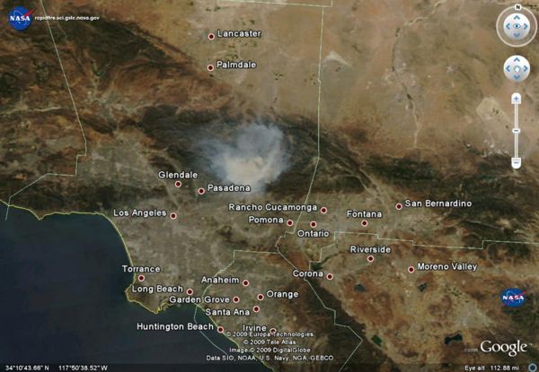
| − | * | + | *MODIS AQUA image of S. Cal. 2009-08-26 |
| + | [[Image: MODIS_AQUA_090826.jpg|600px]] | ||
| + | * [http://www2.aqmd.gov/webappl/gisaqi2/VEMap3D.aspx AQI of S. Ca] from [http://aqmd.gov/ AQMD] - Thanks @ktyler | ||
| + | * [http://webapps.datafed.net/datafed.aspx?dataset_abbr=AIRNOW&datetime=2009-08-26T12:00:00&Loc_code=060370016&time_min=2009-08-20&time_max=2009-09-01&scale_max=300 Airnow PM2.5 for Glendora - Laurel Station] | ||
| + | * [http://webapps.datafed.net/datafed.aspx?dataset_abbr=MODIS4_AOT&datetime=2009-08-25 Modis4 AOT] | ||
| + | * [http://webapps.datafed.net/datafed.aspx?dataset_abbr=NOAA_HMS_WFS&datetime=2008-08-25 NOAA HMS Fire Pixels] | ||
| − | |||
| − | |||
| − | |||
| − | |||
| − | |||
| − | |||
| − | |||
| − | |||
| − | |||
| − | + | {{Event | |
| − | + | |EventTitle=0908 Morris Fire | |
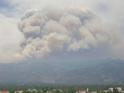
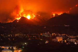
| + | |EventDescription= The so-called Morris Fire started Tuesday just after 4:30 p.m. along North San Gabriel Canyon Road near Morris Dam and Reservoir. | ||
| + | - There is a wealth of information on the event dispersed over the Web<br> | ||
| + | - This wiki is for capturing info resources on the smoke and its air quality impacts<br> | ||
| + | - Users are encouraged to contribute and to <font color="#008000" size="3">'''use the resources to analyze and learn'''</font> | ||
| + | |EventCause= | ||
| + | |Location=Southern California | ||
| + | |StartDate=August 25, 2009 | ||
| + | |EndDate= | ||
| + | |lat_min=30 | ||
| + | |lat_max=38 | ||
| + | |lon_min=-130 | ||
| + | |lon_max=-110 | ||
| + | }} | ||
| − | [[ | + | === Places that ref ESIP AQ Page === |
| + | * [http://sosumi.posterous.com/socal-fires don’s posterous] | ||
| + | * [http://www.boingboing.net/2009/09/01/straight-outta-mordo.html KML exposed] | ||
| − | + | ---- | |
<!-- Categories are tags that allow grouping by features. All datasets have the dataset tag. Atomic pages are the building block pages. Other categories can be added based on type, sensor etc.--> | <!-- Categories are tags that allow grouping by features. All datasets have the dataset tag. Atomic pages are the building block pages. Other categories can be added based on type, sensor etc.--> | ||
Latest revision as of 10:10, December 4, 2021
<< Back to Twitter FUNding Friday Project
Smog Blog Follow-up:
- Sept. 10: SMOKE IS STILL LOCATED OVER THE GREAT LAKES; GOOD AIR QUALITY CONDITIONS ACROSS U.S.
- Sept. 9: SMOKE OVER GREAT LAKES AND AIR QUALITY IMPROVING IN CALIFORNIA
- Sept. 8: MODERATE AIR QUALITY CONTINUES IN MIDWEST; MOSTLY GOOD CONDITIONS ELSEWHERE
Recent Air Quality Data
- [MODIS Aqua and Terra Satellites give a true color image 2x a day See KML
- Fire pixels from Hazard Mapping Service identify the location as seen from satellites of the fires - See KML
- Airnow - Surface monitors indicate the level of PM2.5 on the surface See KML
- NRL NAAPS Smoke Model See KML
All of this data can also be viewed in Google Earth
So Cal Fire News
Failed to load RSS feed from http://news.google.com/news?um=1&ned=us&hl=en&q=so+cal+fires&as_qdr=d&as_drrb=q&output=rss: Error parsing XML for RSS
Twitter feed for SoCal Fire
Videos
YouTube
To add to this list bookmark On delicious with tags (#MorrisFire and video) - All recent videos from
Vimeo
Station Fire, La Canada, CA. August 28, 2009 from Keith Skelton on Vimeo.
Photos
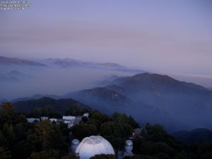
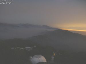
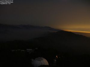
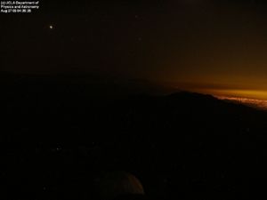
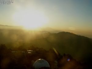
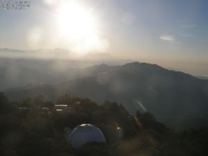
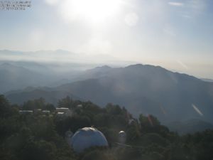
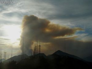
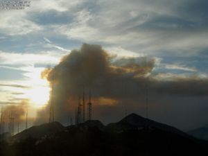
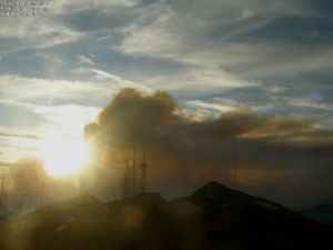
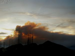
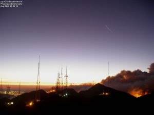
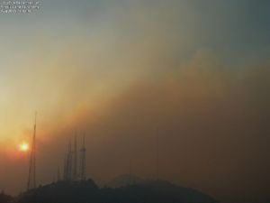
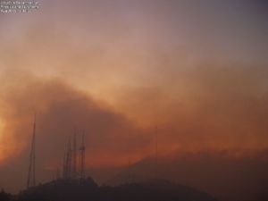
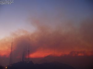
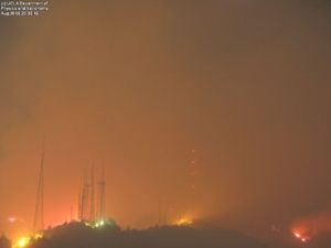
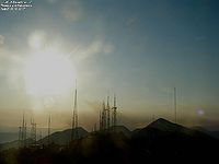
UCLA TowerCam photos - 2009-09-01 back to 2009-08-26
UCLA Astronomy Webcam:
According to the latest blog entry from Dr. McAlister, the Mount Wilson webserver went down. The blog, originally hosted on the Mt.Wilson webserver, is now available here: http://joy.chara.gsu.edu/CHARA/fire.php.

- Twilight pics: 2009-08-26 (8-8:30pm PST)
- Early morning pics: 2009-08-27 (4:30, 6:30 am PST)
- Twilight 2009-08-27 - 7pm, 7:30
- Twilight 2009-08-28 (6:30, 6:50, 6:55, 7:19pm)
- Twilight 2009-08-29 (7:19, 8:04pm)
- Twilight 2008-08-30 (7pm, 7:30pm)
Flickr Photos - Southern California Fire (recent)
Twitpics
Facebook Pics
- Steve Chemtob - taken from the 9th floor of Caltech's Milliken Library, 8/30, ~2 PM.
Blogs
Google Blog Search for Morris Fire Failed to load RSS feed from http://news.google.com/news?ned=us&hl=en&ncl=djFMfdx2B3-VRwMFxHS3grXpM9rVM&rfilter=2&output=rss: Error parsing XML for RSS
Technorati Feed
Morris Fire
Angeles National Forest
AQ Alerts
AQ Data
- MODIS AQUA image of S. Cal. 2009-08-26
- AQI of S. Ca from AQMD - Thanks @ktyler
- Airnow PM2.5 for Glendora - Laurel Station
- Modis4 AOT
- NOAA HMS Fire Pixels
< Back to Exceptional Event List
0908SoCalFire: 0908 Morris Fire
| Description: The so-called Morris Fire started Tuesday just after 4:30 p.m. along North San Gabriel Canyon Road near Morris Dam and Reservoir.
- There is a wealth of information on the event dispersed over the Web |
Places that ref ESIP AQ Page
