Difference between revisions of "AQS d"
(No difference)
| |
Revision as of 10:00, November 17, 2009
AQS_d - AQS
 |
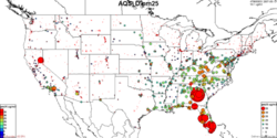
Description: The Air Quality System (AQS) contains ambient air pollution data collected by EPA, state, local, and tribal air pollution control agencies from thousands of monitoring stations. Parameters: NO2 |
- Browse Fields
- RDF for AQS_d <- Should be a property
- What Links here on ESIP wiki
- 400px
Description continued
AQS also contains meteorological data, descriptive information about each monitoring station (including its geographic location and its operator), and data quality assurance/quality control information. The Office of Air Quality Planning and Standards (OAQPS) and other AQS users rely upon the system data to assess air quality, assist in Attainment/Non-Attainment designations, evaluate State Implementation Plans for Non-Attainment Areas, perform modeling for permit review analysis, and other air quality management functions.
User-provided Metadata
AQS_d FAQ's
Lineage
Websites
Websites tagged in d+Link Del.icio.us with: AQS d Link <feed showtitle=false>http://del.icio.us/rss/tag/AQS d+Link</feed>
Papers
Papers tagged in d+Paper Del.icio.us with: dataset AQS d Paper <feed showtitle=false>http://del.icio.us/rss/tag/AQS d+dataset+Paper</feed>
Automatic Searches
- Google Search | Blogs | Scholar | Images | News | Video - PSWC
- Technorati Blogs - PSWC
- Del.icio.us - PSWC
