Seeding an AQ Network
From Earth Science Information Partners (ESIP)
Objectives
- Provide a web space where the principles and vision of a Community Air Quality Information Network can be advanced, tested, nurtured, demonstrated
- to set the stage for a transition to real, operational applications
- enable loosely coupled networking among nodes/participants
Characteristics
- Ability to access, integration, analyze (process) and visualize AQ data
- Lists/catalogs of AQ datasets and tools/services
- Ability to create my own custom applications
- Mechanisms for feedback and annotation
- Connections among different components
Starting Point
- Use existing pieces
- Catalogs (GEOSS, GCMD, DataFed, ...)
- Data access (DataFed, Giovanni, ...)
- Analysis services (DataFed, Giovanni?, Northrop Grumman, )
- Workflows (DataFed, SciFlow, Kepler, WfCS, BPEL)
- Visualization (DataFed, GoogleEarth, NEISGEI, other mashup Applications (GoogleMaps, OpenLayers, AdobeFlex,...)
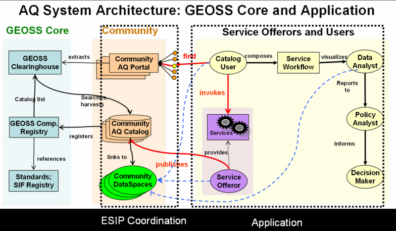
- Architecture/Framework (GEOSS, DataFed,...)
- NO2 Analysis?
- OMI ...
- Surface data ...
- Models ...
- Emissions data ...
- Compare different NO2 products
- Ability of OMI to capture wildfire smoke
- ...
