GEOSS and the AirNOW Data System
What links here: GEOSS and the AirNOW Data System
AirNOW International and GEOSS
The U.S. AirNOW program is a multi-faceted activity consisting of: 1. A federated network of monitors
2. An information infrastructure which collects, archives and disseminates monitoring data
3. Decision-support facilities, e.g. forecasts, alerts, etc.
4. An active community of participants in AirNOW
GEOSS can be viewed as an information infrastructure, like the internet, which connects and enables existing earth observation systems. The monitoring networks and platforms, such as satellites and their local data systems, are typically not considered to be under the direct auspices of GEOSS. The sensor systems/networks can operate in accordance with their mandate, independently of GEOSS.
However, the information network that connects these In the current mode of operation, AirNOW activities could fall under the auspices of the ADC and UIC.
AirNow in an Network
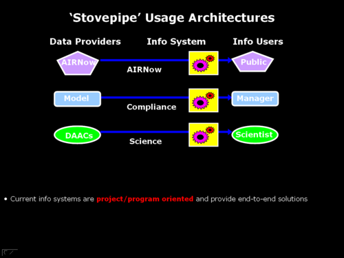
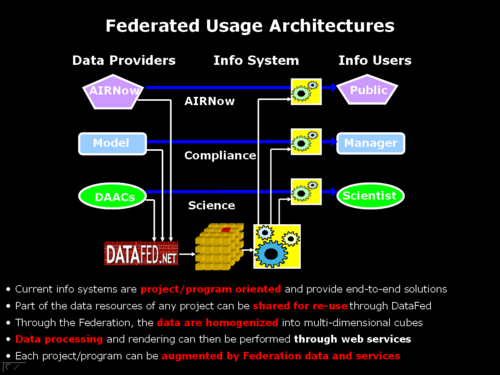
Traditional air quality information systems provide end-to-end solutions through dedicated ‘Stovepipe’ processing streams However, many formerly closed data systems are now opening up and they share their data – through DataFed or other mediators In a federated approach data are homogenized and augmented with services and tools streams… The federated resources in turn can be fed back into individual project processing streams
The transition from the stovepipe to the networked, service oriented architecture can be gradual and non-disruptive.


The implication and the impediments to the implementation of the AirNOW data system transition are two-fold:
- The data provided by the AirNOW data system needs to be accessible through standard interfaces, such as