File:ESIP-Decadal Survey Mapping.jpg
From Earth Science Information Partners (ESIP)
No higher resolution available.
ESIP-Decadal_Survey_Mapping.jpg (720 × 540 pixels, file size: 45 KB, MIME type: image/jpeg)
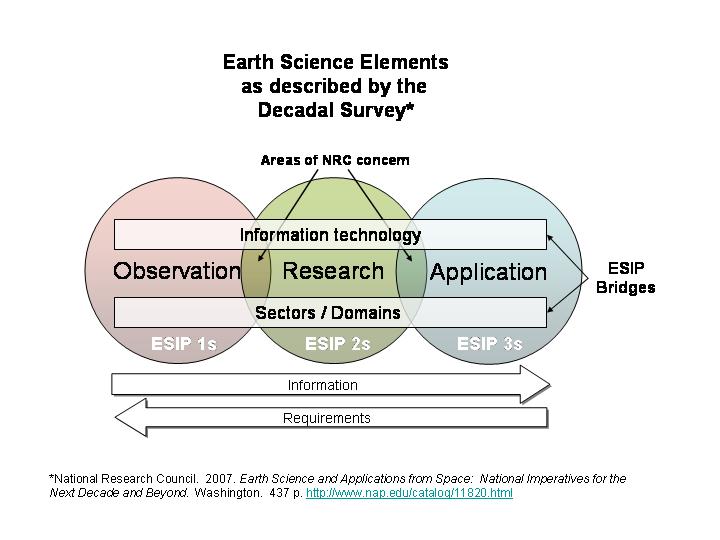
ESIP in Light of Decadal Survey
File history
Click on a date/time to view the file as it appeared at that time.
| Date/Time | Thumbnail | Dimensions | User | Comment | |
|---|---|---|---|---|---|
| current | 12:57, February 8, 2008 | | 720 × 540 (45 KB) | Carolbmeyer (talk | contribs) | ESIP in Light of Decadal Survey |
You cannot overwrite this file.
File usage
The following page uses this file: