100415 IcelandVolcanicErruption Data
<<Back to EventSpace for Iceland Volcano
*** Do you have science data to share about the Volcano? Create an account on this wiki and add directly or Tweet to @ESIPAQWG or e-mail emr1 at wustl dot edu or or tag in delicious with the tags (Iceland volcano Infosource) ****
*** UPDATED: 4-20 11:00 CST ****
Summaries of the Volcano
Agency Summaries
- UK Met Office
- NASA, NASA Earth Observatory Info on Volcanic Ash from NASA's ASAP program
- NERI/AU - Denmark
- EUMETSAT Products
- NOAA
- DLR, Characterization - German Aerospace Center
Blog/WIki Summaries
- Smog Blog is doing daily updates on the volcano
- CIMSS Satellite Blog Volcano posts
- Current Event on Wikipedia
- Ash and Steam Plume from Iceland's Eyjafjallajoekull Volcano, Journal of Earth Science Phenomena, Author: Marty Kellum
Models
Volcanic Ash Advisory Models
- Montreal Volcanic Ash Advisory Models
- Current Advisories for London VAAC
- Forecaster's Blog for London VAAC
National Environmental Research Institute Denmark
The graphics show the amount of air pollution from ground level until 20 km height on a relative scale, where red is the most polluted. The difference between the colours is a factor 10. NERI has assumed that the volcano has emitted the plume to a height of 5-7 km. Please note that the model works in UTC-time. Central European summertime = UTC + 2 hours.
Rhenish Institute for Environment - Germany

ESA Model
- ESA Model for Ash Deposition This animation shows the movement of the ash plume from the eruption of the Eyjafjallajoekull glacier in Iceland.
NILU Model
Norwegian Institue for Air Research - Model - The animations shows dispersion of the eruption from the volcano Eyjafjallajökull.
The animation from Oslo and Bergen also includes the episode from Thursday April 15, where citizens in Bergen and Oslo reported they could smell sulfphur from the eruption in Iceland.
The information in the models has been derived by a model using SO2 as particle tracer for the ash plume. Please note that the time is given in UTC and that the model only includes emissions after 1700 on April 14.
Other Models

Satellites
UK Met Office Gallery of Satellite Images
MODIS
4-19-2009 AQUA Pass

- MODIS Gallery
- MODIS Satellite Image - 4/15 - shared by marksteward 'Pic of ash cloud spreading from Iceland north of UK http://bit.ly/ber3Hp #volcano #ashtag #nasa'
NASA OMI, Atmospheric Composition
- Current OMI Aerosol Index (updated 4/16)


NASA Giovanni OMI Level-2G
Courtesy of James Johnson, NASA:
SO2 | Aerosol Index


GOME 2 Absorbing Aerosol Index - VAAC Support
AIRS and CALIPSO
- From Andrey Savtchenko, NASA: KMZ of AIRS and CALIPSO - Full-resolution (3-km) AIRS Near-Real-TIme false-color imagery, and CALIPSO expedited browse Details

NOAA Visualization
- Animation of volcanic plume impacting Europe - The data shows the concentration of ash in the atmosphere. The ash mass is calculated by combining multiple spectral channels from the EUMETSAT Meteosat-9 satellite's SEVIRI sensor. The latest image from April 19, 2010 is derived from the NASA Aqua/MODIS satellite sensor. These analyses, developed by NOAA scientists, can distinguish between clouds and other atmospheric aerosols.


EUMETSAT

NEODAAS

ENVISAT
- ESA on Flickr - For latest images
- 19 April 2010 by ESA’s Envisat satellite


Radar Obs from Iceland Coastguard
EO-1 Hyperion
From Stu Frye: EO-1 Hyperion image from yesterday [4/17] of the Iceland volcano shown as two side-by-side panels produced from two different spectral ranges,...the left one is SWIR and the right one is visible. In the SWIR, you can see the thermal vent and in the vis you can see the plume coating everything to the SouthEast making the ice brown/gray
- NASA EO-1 Hyperion Image Source and more information on volcano

International Space Station

"Good morning, Europe! Looks like another hazy (ashy?) day for you."
ASTER
This Advanced Spaceborne Thermal Emission and Reflection Radiometer (ASTER) expedited view of the Eyjafjallajökull Volcano was acquired at 12:51 UTC on April 19, 2010 from a 705-km altitude on the Terra spacecraft. The image was generated using ASTER registered radiance at the sensor data, with visible and near-infrared (VNIR) bands simulating natural color. The ground resolution is 15 m. A billowing white and gray plume emanating from Eyjafjallajökull is visible drifting to the south and covering a large area. Expansive snow-covered areas appear white. Vegetation is visible in shades of green, with water dark blue. A density slice overlay using 90 m ground resolution thermal infrared (TIR) band 14 at 10.95 to 11.65 µm wavelengths approximates relative temperatures. The hottest pixels are portrayed in yellow, representing the highest TIR band 14 digital numbers in this scene. While still hot, the TIR pixels colored orange and red are at relatively lower temperatures. Another hot area representing an earlier and now-cooling flow is evident northeast of Eyjafjallajökull at Fimmvörduháls.
For more information on ASTER see:

Surface Observations
Airports
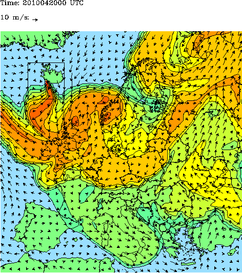
UK Met Office
Air Quality Now
Air Quality Now EU Map - Failed to load RSS feed from http://www.airqualitynow.eu/rss.php: Error parsing XML for RSS
GEMS
Webcams
Photos
- Photos from Mercury_3488
@ESIPAQWG Today's photographic spam from me :) http://www.space.com/common/forums/viewtopic.php?f=16&t=23777&p=447168#p447168
Tag in Delicious with 'Volcano Iceland Infosource'
All Iceland Volcano links: http://delicious.com/tag/Volcano+Iceland+Infosource