Search results
From Earth Science Information Partners (ESIP)

File:Witch Fire.pdf (991 KB) - 12:45, October 25, 2007
File:GDSG FIRE map.png (932 × 482 (24 KB)) - 13:50, December 30, 2006
File:HMS Fire map.png (932 × 482 (35 KB)) - 13:53, December 30, 2006
File:MODIS FIRE map.png (900 × 500 (40 KB)) - 10:05, April 18, 2013
File:GDSG Fire map.png (932 × 482 (24 KB)) - 19:55, January 21, 2008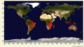
File:MODIS Global Fire map.png (800 × 450 (324 KB)) - 13:55, December 30, 2006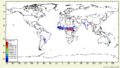
File:RETRO FIRE AGGR map.png (800 × 450 (31 KB)) - 13:39, January 10, 2008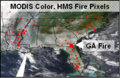
File:070524 MODIS Color HMS Fire Pixels GA.png (348 × 227 (175 KB)) - 12:45, May 26, 2008
File:Sep20 2007 AMDSeminarForC.ppt other aerosol parameters. Wildfire emissions were refined using NASA/MODIS fire count product from University of Maryland. These studies gave information(4.5 MB) - 16:07, January 3, 2008File:Datasheet template 03 07 NOAA HMS.doc Draft DataSheet for NOAA Hazard Mapping System fire and smoke data(123 KB) - 21:00, January 5, 2009
File:FireEmissions.png (1,280 × 742 (206 KB)) - 06:53, July 18, 2007
File:FireLocations.png (599 × 686 (38 KB)) - 06:53, July 18, 2007File:FirePixelAnalysis.ppt (36 KB) - 00:03, February 26, 2007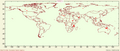
File:ASTR FIREd map.png (950 × 400 (58 KB)) - 13:43, December 30, 2006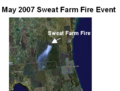
File:SweatFarmFire.png (441 × 335 (168 KB)) - 17:24, June 22, 2008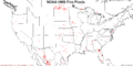
File:HMS FirePix.png (1,200 × 600 (47 KB)) - 23:19, April 9, 2008
File:FireLocFlow.png (870 × 634 (30 KB)) - 06:53, July 18, 2007File:071030 SCAL Fires.ppt (1.92 MB) - 17:19, October 30, 2007
File:RETRO FIRES WCS map.png (231 × 125 (22 KB)) - 12:19, July 18, 2007
File:FS FuelFire map.png (932 × 482 (252 KB)) - 13:49, December 30, 2006


