Difference between revisions of "MD GridSpatialRepresentation"
From Earth Science Information Partners (ESIP)
| (2 intermediate revisions by the same user not shown) | |||
| Line 1: | Line 1: | ||
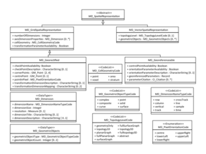
| + | [[File:MD_SpatialRepresentation.png|thumb|right|MD_SpatialRepresentation]] | ||
== msr:MD_GridSpatialRepresentation == | == msr:MD_GridSpatialRepresentation == | ||
| − | |||
<div id="elementsAndDefinitions"> | <div id="elementsAndDefinitions"> | ||
| Line 12: | Line 12: | ||
</tr> | </tr> | ||
<tr> | <tr> | ||
| − | <td bgcolor="FFFF99"> | + | <td bgcolor="CCFFFF">1</td> |
| + | <td bgcolor="CCFFFF">[[MD_Scope|msr:scope]]</td> | ||
| + | <td bgcolor="CCFFFF">0..1</td> | ||
| + | <td bgcolor="CCFFFF">[[MD_Scope|mcc:MD_Scope]]</td> | ||
| + | <td>Level and extent of the spatial representation</td> | ||
| + | <td><i></i></td> | ||
| + | </tr> | ||
| + | <tr> | ||
| + | <td bgcolor="FFFF99">2</td> | ||
<td bgcolor="FFFF99">[[Integer|msr:numberOfDimensions]]</td> | <td bgcolor="FFFF99">[[Integer|msr:numberOfDimensions]]</td> | ||
<td bgcolor="FFFF99">1</td> | <td bgcolor="FFFF99">1</td> | ||
| Line 20: | Line 28: | ||
</tr> | </tr> | ||
<tr> | <tr> | ||
| − | <td bgcolor="CCFFFF"> | + | <td bgcolor="CCFFFF">3</td> |
<td bgcolor="CCFFFF">[[MD_Dimension|msr:axisDimensionProperties]]</td> | <td bgcolor="CCFFFF">[[MD_Dimension|msr:axisDimensionProperties]]</td> | ||
<td bgcolor="CCFFFF">0..*</td> | <td bgcolor="CCFFFF">0..*</td> | ||
| Line 27: | Line 35: | ||
<td><i></i></tr> | <td><i></i></tr> | ||
<tr> | <tr> | ||
| − | <td bgcolor="FFFF99"> | + | <td bgcolor="FFFF99">4</td> |
| − | <td bgcolor="FFFF99">[[ | + | <td bgcolor="FFFF99">[[ISO_19115-3_Codelists#MD_CellGeometryCode|msr:cellGeometry]]</td> |
<td bgcolor="FFFF99">1</td> | <td bgcolor="FFFF99">1</td> | ||
| − | <td bgcolor="FFFF99">[[ | + | <td bgcolor="FFFF99">[[ISO_19115-3_Codelists#MD_CellGeometryCode|msr:MD_CellGeometryCode]]</td> |
<td>Identification of grid data as point or cell</td> | <td>Identification of grid data as point or cell</td> | ||
<td><i></i></td> | <td><i></i></td> | ||
</tr> | </tr> | ||
<tr> | <tr> | ||
| − | <td bgcolor="FFFF99"> | + | <td bgcolor="FFFF99">5</td> |
<td bgcolor="FFFF99">[[Boolean|msr:transformationParameterAvailability]]</td> | <td bgcolor="FFFF99">[[Boolean|msr:transformationParameterAvailability]]</td> | ||
<td bgcolor="FFFF99">1</td> | <td bgcolor="FFFF99">1</td> | ||
Latest revision as of 07:44, October 30, 2018
msr:MD_GridSpatialRepresentation
| Elements | Domain | Definition and Recommended Practice | Examples | ||
|---|---|---|---|---|---|
| 1 | msr:scope | 0..1 | mcc:MD_Scope | Level and extent of the spatial representation | |
| 2 | msr:numberOfDimensions | 1 | gco:Integer | Number of independent spatial-temporal axes | |
| 3 | msr:axisDimensionProperties | 0..* | msr:MD_Dimension | Information about spatial-temporal axis properties | |
| 4 | msr:cellGeometry | 1 | msr:MD_CellGeometryCode | Identification of grid data as point or cell | |
| 5 | msr:transformationParameterAvailability | 1 | gco:Boolean | Indication of whether or not parameters for transformation between image coordinates and geographic or map coordinates exist (are available) | |
Can be substituted with either:
Please contribute!
- transformationParameterAvailability
- indication of whether or not parameters for transformation between image coordinates and geographic or map coordinates exist (are available).
- Plain English
- Select yes, if the map coordinates are available in the file headers or related dataset documentation have enough information to re-project the data.


