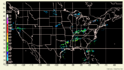
NEXRAD WMS
From Earth Science Information Partners (ESIP)
NEXRAD_WMS - NEXRAD
 |
Description: NEXRAD_RADAR is a standard dataset of radar reflectivity images for the U.S. The hourly NEXTRAD radar maps are by the National Climatic Data Center. In FASTNET the radar data are used to delineate the spatial-temporal pattern of precipitation. Parameters: Reflectivity, Precipitation |
- Browse Fields
- RDF for NEXRAD_WMS <- Should be a property
- What Links here on ESIP wiki
- 400px
User-Contributioned Resources. See also discussion page. Help on Edit.
Dataset Description
Data description here
Related Links
